Redesign preview, built by Digital LotusEdit this site →

Jack London Square

Multi-modal connections where Oakland meets the Bay, and bold new markers for Water Street.

Location
Oakland, CA
Sector
Civic, Mixed Use, Transit, Waterfront
Service
Repositioning, Wayfinding & Signage
Client
CIM Group
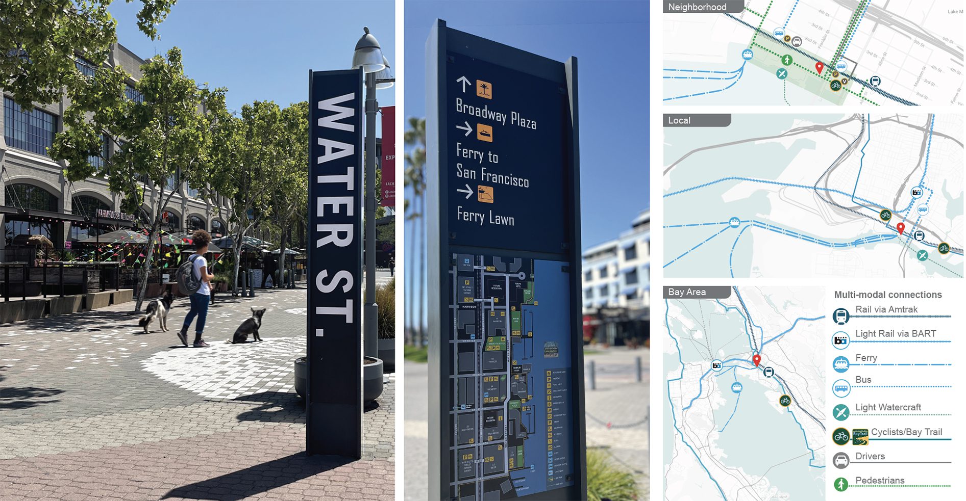
Water Street marker, pedestrian directional and neighborhood maps at Jack London Square
Water Street markers with neighborhood maps, and the multi-modal map system linking rail, ferry, bus and the Bay Trail.

Overview

Improving connections within the site and beyond, with links to the Bay Trail, the SF Ferry, Amtrak and light watercraft.

The sign program defines paths of travel to encourage pedestrian exploration and add clarity. The six foot tall Water St sign marches at a regular cadence, identifying the pedestrian promenade as its own distinct place on the Oakland waterfront. Scope also included visioning and palette development for the streetscape and furniture.
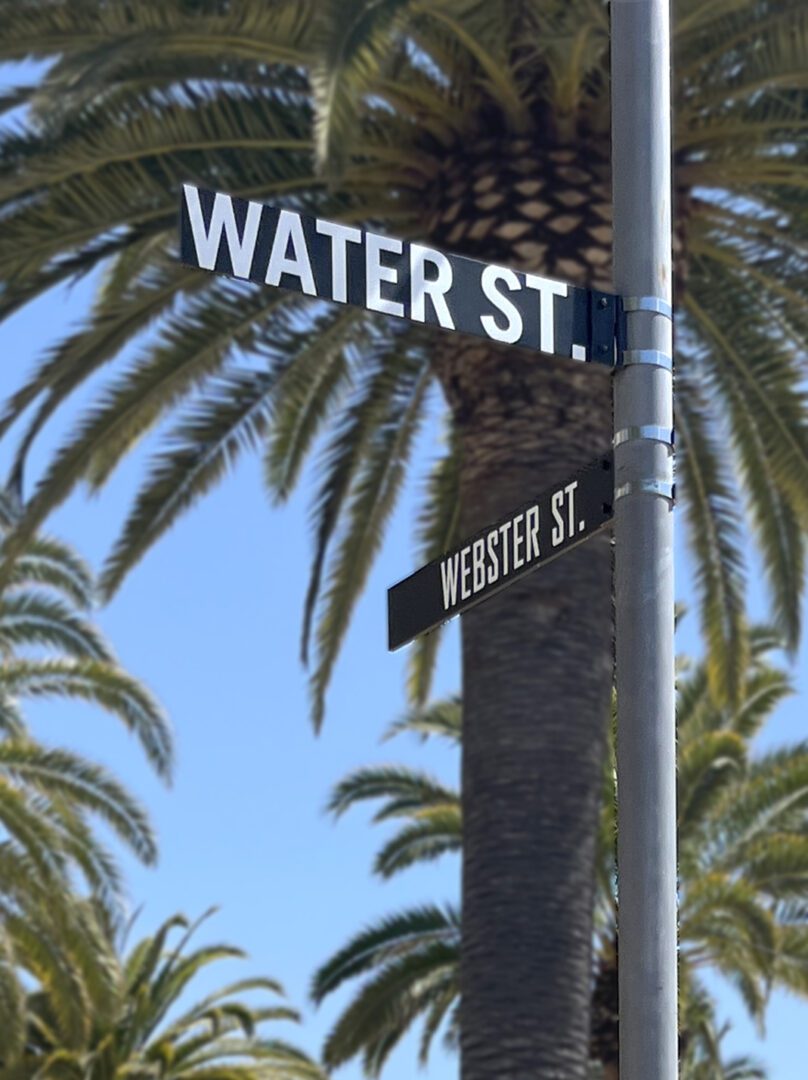
Water St. and Webster St. pole-mounted street signs against palm trees
Marking a pathWhen the project started, Water Street had been a dedicated pedestrian walkway for decades. The street was visible on GPS maps but it lacked street signs. In addition to the large Water Street markers with neighborhood maps on one side, smaller pole-mounted signs were used where a lighter touch was needed.
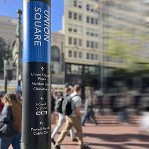
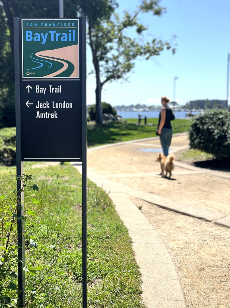
San Francisco Bay Trail marker integrated with the Jack London neighborhood sign system
Strong edgesThe Bay Trail is a 500 mile loop for walking, running or cycling around the entire bay. It was critical to maintain continuity of this identity where the path bisected Jack London Square. The sign integrates the Bay Trail marker with Jack London's neighborhood sign system, connecting the dots and bridging to other important travel destinations.

More case studies

All 122 projects →

Contact

Send us a message

Emailinfo@studio-montgomery.com
Phone+1 (626) 676-3625
StudioLos Angeles, CA